Integration & Technologies
Integration & Technologies
How VTS and PMIS work as one system — data flows, enabling technologies and architecture
Integrated operational scenario
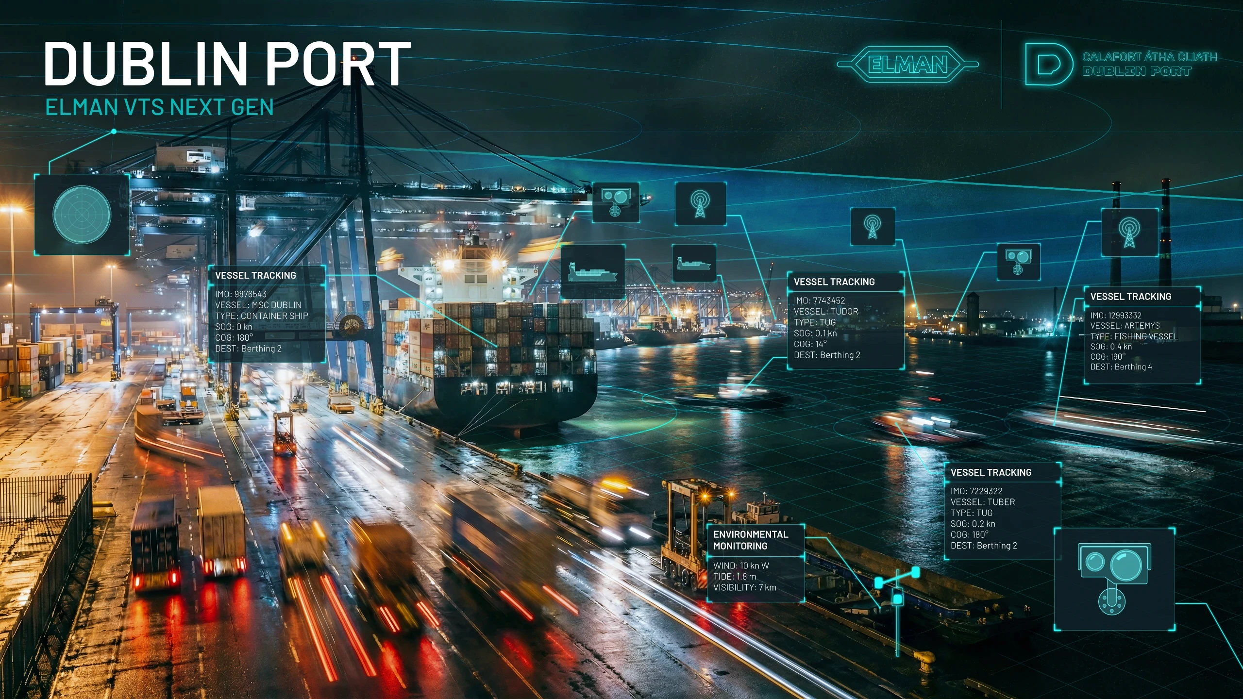
Consider a container ship 50 nautical miles from port. VTS picks it up on AIS and long-range radar. Its ETA is automatically pushed to PMIS, which checks berth availability, resolves any conflict with another vessel's departure, and dispatches booking confirmations to the pilot station and tug operator — without any manual data entry.
Simultaneously, PMIS verifies that all FAL declarations, the cargo manifest and dangerous goods notifications have been received via the Single Window. If the customs pre-clearance is pending, the system flags this to the shipping agent with a timestamped alert — hours before the vessel arrives, when there is still time to resolve it.
Reduced anchor waiting time by up to 60%
Reduced anchor waiting time by up to 60%
Zero manual ETA updates between VTS and port planner
Zero manual ETA updates between VTS and port planner
Cargo operations ready before vessel berths
Cargo operations ready before vessel berths
Customs pre-clearance completed before arrival
Customs pre-clearance completed before arrival

Real-time data flows
Bidirectional information exchange between VTS and PMIS subsystems
VTS Subsystem
Radar / AIS fused track data
Real-time vessel positions
Navigation alerts & NAVTEX
Weather / tidal conditions
VHF communication logs
CCTV event markers
VTS
Vessel Position (AIS)
PMIS
VTS
Planned ETA/ETD
PMIS
VTS
Navigation status
PMIS
VTS
Berth plan
PMIS
VTS
Safety alerts
PMIS
VTS
Entry permits
PMIS
PMIS Subsystem
Port call schedule & ETA
Berth assignments
FAL documentation status
Cargo manifest data
Entry authorisations
Resource bookings
Integration benefits
Full situational awareness
Operators see position, document status, berth plan and cargo of every vessel simultaneously.
Full situational awareness
Operators see position, document status, berth plan and cargo of every vessel simultaneously.
Automated notifications
Waypoint crossing triggers automatic ETA updates, pilot alerts and terminal readiness signals.
Automated notifications
Waypoint crossing triggers automatic ETA updates, pilot alerts and terminal readiness signals.
Single point of truth
One shared database eliminates discrepancies between VTS, Harbour Master, Customs and Port Authority.
Single point of truth
One shared database eliminates discrepancies between VTS, Harbour Master, Customs and Port Authority.
Decision support algorithms
Predictive tools calculate delay impacts, berth conflicts and optimal routing in real time.
Decision support algorithms
Predictive tools calculate delay impacts, berth conflicts and optimal routing in real time.
Incident timeline reconstruction
Fused AIS, radar, VHF and CCTV logs provide irrefutable evidence for accident investigation.
Incident timeline reconstruction
Fused AIS, radar, VHF and CCTV logs provide irrefutable evidence for accident investigation.
Just-in-time arrival
Port congestion prediction allows vessels to slow-steam, reducing fuel burn and anchor waiting time.
Just-in-time arrival
Port congestion prediction allows vessels to slow-steam, reducing fuel burn and anchor waiting time.
Enabling technologies
The technology stack powering VTMIS
AIS - Automatic Identification System
VHF transponder broadcasting vessel identity, position, speed and course every 2–10 seconds. VTMIS fuses AIS with radar to create a de-duplicated, high-integrity operational picture. Class A mandatory for SOLAS vessels > 300 GT.
VHF transponder broadcasting vessel identity, position, speed and course every 2–10 seconds. VTMIS fuses AIS with radar to create a de-duplicated, high-integrity operational picture. Class A mandatory for SOLAS vessels > 300 GT.
Data Integration Bus
The middleware layer aggregates data streams from AIS, radar, VHF, CCTV, meteo and external systems (SafeSeaNet, customs), normalises them into a unified format and distributes them to VTS and PMIS subsystems via standardised APIs.
The integration bus applies data quality rules, handles latency and deduplication, and provides audit trails. It is the architectural backbone that makes VTMIS 'one system' rather than a collection of siloed tools.
SafeSeaNet — European Maritime Data Exchange
SafeSeaNet (SSN) is EMSA's platform for cross-border maritime information sharing. PMIS automatically forwards vessel notifications, cargo declarations and hazardous goods reports to SSN, which routes them to all relevant EU member states.
SafeSeaNet interfaces include SSTP (SafeSeaNet Transfer Protocol) for structured message exchange and the THETIS system for port state control inspection scheduling and follow-up.
VDES — VHF Data Exchange System
VDES is the next-generation successor to AIS for digital ship-shore communication. It provides much higher data throughput over VHF, enabling exchange of voyage plans, weather data and port information that far exceed AIS bandwidth.
VDES is being introduced progressively from 2024 onwards, starting in test areas. VTMIS platforms are architected to support VDES alongside legacy AIS for a long dual-mode transition period.
ARPA Radar — Automatic Radar Plotting Aid
Shore-based X-band and S-band radar arrays provide continuous surveillance. ARPA algorithms automatically track targets, calculate Closest Point of Approach (CPA) and Time to CPA (TCPA), and generate collision risk alerts.
Radar is the primary sensor for vessels without AIS or in AIS-shadow areas. Modern radars achieve target detection at 48+ nautical miles with tracking accuracy of ±10 metres.
Maritime Connectivity Platform & PKI
The Maritime Connectivity Platform (MCP) provides a secure, standards-based framework for digital maritime communication. PKI certificates issued under the Maritime Resource Name (MRN) scheme authenticate vessels, services and personnel.
All VTMIS external communications — including SafeSeaNet data exchange and port authority APIs — are authenticated via MCP certificates, ensuring data integrity and non-repudiation in legal and incident contexts.
ECDIS & Electronic Navigational Charts
The Electronic Chart Display and Information System presents VTS data — vessel tracks, AIS targets, weather overlays, navigational warnings — on digital nautical charts (ENC) compliant with IHO S-57 and the new S-101 standard.
VTS operators annotate the ECDIS with vessel assignments, restricted areas and incident markers. The same chart environment connects to PMIS berth planning, so a vessel's route and berth assignment are visible in one view.
e-Navigation & Digital Services
IMO's e-Navigation strategy (MSC-MEPC.2/Circ.15) coordinates the harmonised development of maritime digital services, voyage planning, met-ocean data, AtoN information — delivered to vessels and shore authorities through standardised interfaces.
VTMIS is a key shore-side node in the e-Navigation ecosystem, providing vessels with accurate, validated port approach information (depths, berth availability, traffic) through standardised data services.
AIS - Automatic Identification System
VHF transponder broadcasting vessel identity, position, speed and course every 2–10 seconds. VTMIS fuses AIS with radar to create a de-duplicated, high-integrity operational picture. Class A mandatory for SOLAS vessels > 300 GT.
VHF transponder broadcasting vessel identity, position, speed and course every 2–10 seconds. VTMIS fuses AIS with radar to create a de-duplicated, high-integrity operational picture. Class A mandatory for SOLAS vessels > 300 GT.
ARPA Radar — Automatic Radar Plotting Aid
Shore-based X-band and S-band radar arrays provide continuous surveillance. ARPA algorithms automatically track targets, calculate Closest Point of Approach (CPA) and Time to CPA (TCPA), and generate collision risk alerts.
Radar is the primary sensor for vessels without AIS or in AIS-shadow areas. Modern radars achieve target detection at 48+ nautical miles with tracking accuracy of ±10 metres.
Data Integration Bus
The middleware layer aggregates data streams from AIS, radar, VHF, CCTV, meteo and external systems (SafeSeaNet, customs), normalises them into a unified format and distributes them to VTS and PMIS subsystems via standardised APIs.
The integration bus applies data quality rules, handles latency and deduplication, and provides audit trails. It is the architectural backbone that makes VTMIS 'one system' rather than a collection of siloed tools.
Maritime Connectivity Platform & PKI
The Maritime Connectivity Platform (MCP) provides a secure, standards-based framework for digital maritime communication. PKI certificates issued under the Maritime Resource Name (MRN) scheme authenticate vessels, services and personnel.
All VTMIS external communications — including SafeSeaNet data exchange and port authority APIs — are authenticated via MCP certificates, ensuring data integrity and non-repudiation in legal and incident contexts.
SafeSeaNet — European Maritime Data Exchange
SafeSeaNet (SSN) is EMSA's platform for cross-border maritime information sharing. PMIS automatically forwards vessel notifications, cargo declarations and hazardous goods reports to SSN, which routes them to all relevant EU member states.
SafeSeaNet interfaces include SSTP (SafeSeaNet Transfer Protocol) for structured message exchange and the THETIS system for port state control inspection scheduling and follow-up.
ECDIS & Electronic Navigational Charts
The Electronic Chart Display and Information System presents VTS data — vessel tracks, AIS targets, weather overlays, navigational warnings — on digital nautical charts (ENC) compliant with IHO S-57 and the new S-101 standard.
VTS operators annotate the ECDIS with vessel assignments, restricted areas and incident markers. The same chart environment connects to PMIS berth planning, so a vessel's route and berth assignment are visible in one view.
VDES — VHF Data Exchange System
VDES is the next-generation successor to AIS for digital ship-shore communication. It provides much higher data throughput over VHF, enabling exchange of voyage plans, weather data and port information that far exceed AIS bandwidth.
VDES is being introduced progressively from 2024 onwards, starting in test areas. VTMIS platforms are architected to support VDES alongside legacy AIS for a long dual-mode transition period.
e-Navigation & Digital Services
IMO's e-Navigation strategy (MSC-MEPC.2/Circ.15) coordinates the harmonised development of maritime digital services, voyage planning, met-ocean data, AtoN information — delivered to vessels and shore authorities through standardised interfaces.
VTMIS is a key shore-side node in the e-Navigation ecosystem, providing vessels with accurate, validated port approach information (depths, berth availability, traffic) through standardised data services.
AIS - Automatic Identification System
VHF transponder broadcasting vessel identity, position, speed and course every 2–10 seconds. VTMIS fuses AIS with radar to create a de-duplicated, high-integrity operational picture. Class A mandatory for SOLAS vessels > 300 GT.
VHF transponder broadcasting vessel identity, position, speed and course every 2–10 seconds. VTMIS fuses AIS with radar to create a de-duplicated, high-integrity operational picture. Class A mandatory for SOLAS vessels > 300 GT.
ARPA Radar — Automatic Radar Plotting Aid
Shore-based X-band and S-band radar arrays provide continuous surveillance. ARPA algorithms automatically track targets, calculate Closest Point of Approach (CPA) and Time to CPA (TCPA), and generate collision risk alerts.
Radar is the primary sensor for vessels without AIS or in AIS-shadow areas. Modern radars achieve target detection at 48+ nautical miles with tracking accuracy of ±10 metres.
Data Integration Bus
The middleware layer aggregates data streams from AIS, radar, VHF, CCTV, meteo and external systems (SafeSeaNet, customs), normalises them into a unified format and distributes them to VTS and PMIS subsystems via standardised APIs.
The integration bus applies data quality rules, handles latency and deduplication, and provides audit trails. It is the architectural backbone that makes VTMIS 'one system' rather than a collection of siloed tools.
Maritime Connectivity Platform & PKI
The Maritime Connectivity Platform (MCP) provides a secure, standards-based framework for digital maritime communication. PKI certificates issued under the Maritime Resource Name (MRN) scheme authenticate vessels, services and personnel.
All VTMIS external communications — including SafeSeaNet data exchange and port authority APIs — are authenticated via MCP certificates, ensuring data integrity and non-repudiation in legal and incident contexts.
SafeSeaNet — European Maritime Data Exchange
SafeSeaNet (SSN) is EMSA's platform for cross-border maritime information sharing. PMIS automatically forwards vessel notifications, cargo declarations and hazardous goods reports to SSN, which routes them to all relevant EU member states.
SafeSeaNet interfaces include SSTP (SafeSeaNet Transfer Protocol) for structured message exchange and the THETIS system for port state control inspection scheduling and follow-up.
ECDIS & Electronic Navigational Charts
The Electronic Chart Display and Information System presents VTS data — vessel tracks, AIS targets, weather overlays, navigational warnings — on digital nautical charts (ENC) compliant with IHO S-57 and the new S-101 standard.
VTS operators annotate the ECDIS with vessel assignments, restricted areas and incident markers. The same chart environment connects to PMIS berth planning, so a vessel's route and berth assignment are visible in one view.
VDES — VHF Data Exchange System
VDES is the next-generation successor to AIS for digital ship-shore communication. It provides much higher data throughput over VHF, enabling exchange of voyage plans, weather data and port information that far exceed AIS bandwidth.
VDES is being introduced progressively from 2024 onwards, starting in test areas. VTMIS platforms are architected to support VDES alongside legacy AIS for a long dual-mode transition period.
e-Navigation & Digital Services
IMO's e-Navigation strategy (MSC-MEPC.2/Circ.15) coordinates the harmonised development of maritime digital services, voyage planning, met-ocean data, AtoN information — delivered to vessels and shore authorities through standardised interfaces.
VTMIS is a key shore-side node in the e-Navigation ecosystem, providing vessels with accurate, validated port approach information (depths, berth availability, traffic) through standardised data services.
VTMIS architecture layers
Presentation Layer
Application Layer
Integration layer
Data layer
Sensor / network layer
Informational portal on the Vessel Traffic Management and Information System. Resources on VTS, PMIS and international maritime navigation standards.
International Maritime Organization
Intl. Association of Marine Aids to Nav.
European Maritime Safety Agency
EU vessel traffic monitoring and information system
Informational portal on the Vessel Traffic Management and Information System. Resources on VTS, PMIS and international maritime navigation standards.
International Maritime Organization
Intl. Association of Marine Aids to Nav.
European Maritime Safety Agency
EU vessel traffic monitoring and information system
Informational portal on the Vessel Traffic Management and Information System. Resources on VTS, PMIS and international maritime navigation standards.
International Maritime Organization
Intl. Association of Marine Aids to Nav.
European Maritime Safety Agency
EU vessel traffic monitoring and information system